

South Falls at Silver Falls State Park: An Oregon Waterfall Day Trip
A South Falls-focused day visit to Silver Falls State Park during our Allegiant-supported Oregon trip, with walk-behind waterfall views and practical planning notes.
Read the story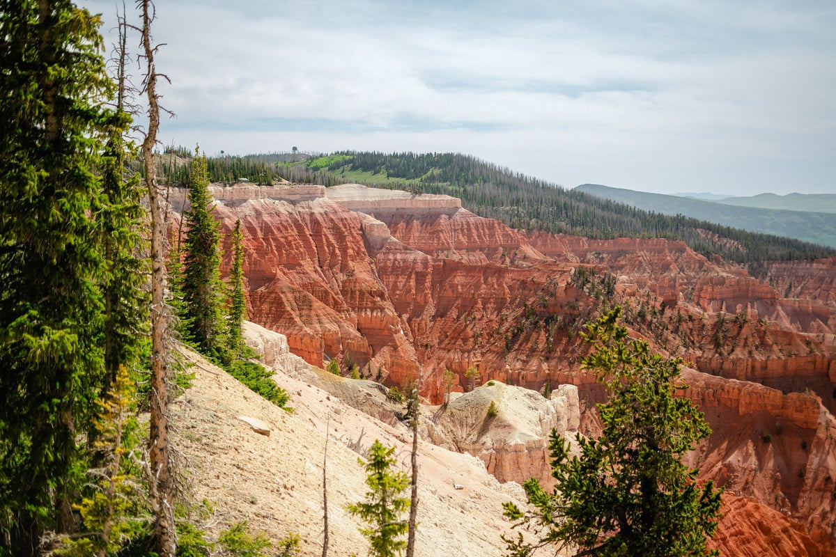
Our Cedar Breaks visit included rim overlooks, a picnic near Chessman Ridge and a short out-and-back before returning to North View for sunset.

I love Cedar Breaks. On this visit we explored several overlooks, took a short hike for a different perspective and made it back to North View for sunset. It was part of the same day we spent around Brian Head, but there was plenty here to make it feel like its own outing.
We stopped at North View, the Alpine Pond access area and Point Supreme, and had a little picnic near Chessman Ridge. The benches and places to sit were really nice between walks. We also enjoyed talking with rangers and learning more about what we were looking at.
Our visit focused on the overlooks, so this is a stop you can consider even if you are not planning a long hike. Point Supreme, Sunset View and Chessman Ridge are reached from the seasonal State Route 148 corridor. North View is accessed from State Route 143. The park’s road and facility updates help you work out which stops fit your route.
When the seasonal visitor facilities are open, stop at the visitor center and Human History Museum for some background before exploring. The Point Supreme picnic area is another useful stop if you bring lunch. It is first come, first served, so there is no picnic reservation to arrange.

Cedar Breaks is part of the homeland of the Southern Paiute people, whose history here predates its protection as a national monument. The English name came later: settlers called local junipers “cedars,” while “breaks” referred to the abrupt change in the terrain. President Franklin D. Roosevelt established the monument in 1933. The park’s history page introduces the people connected to the area.
Some of the work that made the monument accessible happened during the Great Depression. From 1934 to 1938, Civilian Conservation Corps crews built roads, trails, parking areas and campground facilities. They also constructed a museum and ranger cabin. That history adds another reason to stop at the museum rather than treating Cedar Breaks only as a viewpoint along the drive.
We started a short out-and-back from the Rattlesnake Creek trailhead. The walk went through trees before opening up along the ridge, where we could look back toward the other viewpoints. That different perspective was beautiful.
We went as far as the beginning of the switchbacks and a little way down, then turned around as the light started fading. We wanted to get back to North View for sunset. We did not complete the full trail, so I would not use our short outing as a guide to the time or difficulty of the whole route.
To add a walk to your overlook stops, use the park’s trail guide to choose a route. Sunset Trail is a paved, accessible route between Point Supreme and Sunset View, with a two-mile round trip and places to rest along the way.
Alpine Pond offers a different outing through the forest, with one-mile and two-mile loop options. For a longer hike, South Rim Trail reaches Spectra Point after one mile each way and continues farther along the rim. The return includes uphill walking, so choose your turnaround point with that in mind.

Cedar Breaks is above 10,000 feet. Bring layers and water, check the forecast and leave exposed areas if storms develop. Afternoon lightning can be dangerous.
State Route 148 generally closes to vehicles from mid-November to mid-May, depending on snow. Visitor buildings have a separate seasonal schedule, so an open road does not necessarily mean all facilities are open. Use NPS current conditions before setting out.
Cedar Breaks also pairs with a visit to nearby Brian Head Peak. Our Brian Head article includes the history of the stone summit shelter and planning notes for an evening visit. Keep road access and the forecast in mind when deciding whether to include both stops.

A South Falls-focused day visit to Silver Falls State Park during our Allegiant-supported Oregon trip, with walk-behind waterfall views and practical planning notes.
Read the story
The cave opening and Oregon coastline.Our Oregon Coast stop included sea lions on the rocks, time inside the cave, coastal viewpoints and a few favorite...
Read the story
A photo-led look at Weavers Needle from Fremont Saddle, with a Peralta Trail hiking option, preparation advice, and practical desert photography tips.
Read the storySign up for new stories, photographs, and notes from the road.
Join the conversation